

 A 2-day circuit of the Deadwater hills of the Kielder Forest region, largely following the route of the old ‘Kielder Stane’ Trail, now called the Deadwater Trail (DWT) on some marker posts.
We had pondered the Kielder Forest area for some time on the maps, a region encompassing a number of new hills including Peel Fell, a Dewey summit and our one remaining unclimbed 600m hill in England – the ‘SiMS’ list. This route traverses Peel Fell and includes Deadwater Fell, another new summit from the Dewey 500m hills, a circuit that seemed right for the predicted conditions.
The route is one of sharp contrast: the ascent of Deadwater Fell, and the descent through Deadwater Forest and return along the North Tyne valley, are very easy walking on good paths and tracks, but the traverse of Mid Fell and Peel Fell is typical north Pennine peat bog of heathery hags, tussocks and sphagnum. Despite being a named trail and furnished with a few waymark posts, the latter section is not sanitized in any way and after a wet spell is potentially very boggy in a few places. The line is almost always discernible on the ground though with even a few brief fragments of good path.
We saw several sketchy accounts of these hills online, and this being a sunny Sunday morning we expected to see at least a few walkers on the ascent from the Kielder Visitor Centre, but we saw nobody at all and the area was deserted for the whole trip.
The old Outdoor Leisure map shows this route but the newer Explorer map does not. Typically each revision of a 1:25,000 map shows various new named walks springing up here and there, but this is the first case I recall of a trail being removed.
 A 2-day mountain circuit centred on Cwm Caseg in the NW Carneddau. The outward route follows the north side of the Afon Caseg valley and ascends into the heart of the cwm to Ffynnon Caseg, then climbs Yr Elen and Carnedd Llewelyn. The return route is via Foel Grach and the mountains along the Carnedd Gwenllian / Gyrn Wigau chain.
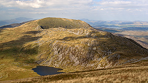 A 2-day circuit of the southern Rhinogydd mountains around the Afon Ysgethin valley.
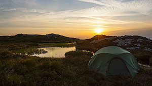 A 2-day circuit of the south-eastern Carneddau hills flanking Llyn Cowlyd, approaching the eastern side via the Nant y Geuallt valley to Crimpiau with a visit to Llyn Coryn and ascending alongside the rocky flanks of Craig Wen to Craiglwyn and Creigiau Gleision. The return on the western side traverses Pen Llithrig y Wrach and includes our first exploration of its north ridge.
 A 2-day backpack around the hills and cwms of the upper Tanat valley of north-east Wales, visiting a couple of new Dewey 500m summits.
 A 2-day circuit of the hills flanking Garsdale, a choice inspired by an overlap with a bank holiday weekend to avoid the influx of walkers to the well known areas – it was a good one in that respect, we saw nobody at all and the whole area was completely deserted. The tent pitch was an excellent one with a grand sunrise.
 A short 2-day out-and-back solo trip approaching Tryfan from the east via Gallt yr Ogof and Y Foel Goch.
 Another 2-day circuit of Cwm Eigiau, this time exploring the excellent upper reaches of the cwm below the eastern cliffs of Carnedd Llewelyn, a very seldom trodden pocket of the Carneddau cradling the hidden Ffynnon Llyffant, the highest lake in Wales. This exquisite wild rocky mountain landscape shows once again the rewards of leaving the paths and backpacking the little known corners: in favourable conditions there are real gems to be discovered.